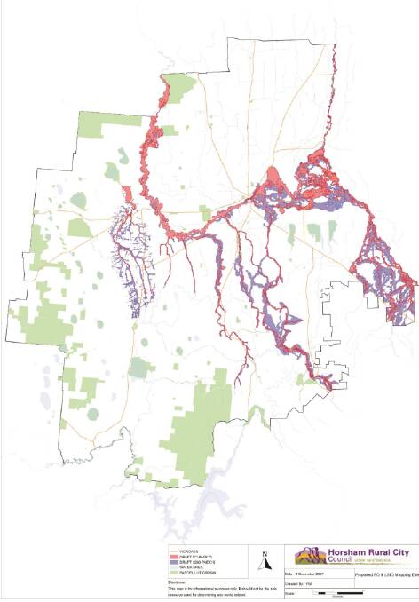
HORSHAM council are developing a flooding amendment to protect properties in the municipality using the most up-to-date information.
Subscribe now for unlimited access.
$0/
(min cost $0)
or signup to continue reading
At its February meeting, council voted to officially request ministerial authorisation and to seek community consultation for Amendment C81 to amend the flood controls in the Horsham Planning Scheme.
Horsham mayor Robyn Gulline said the amendment was reflecting vital data.
"The Wimmera Catchment Management Authority had done six flood studies since 2009/10 and each of those studies recommend that the flood overlay and the land subject to inundation overlay be amended," she said.
"The amendments will be updated to cover those flood affected areas."
IN OTHER NEWS:
The maps will be focused on a flood probability of 1 in 100 year flood which is one per cent Annual Exceedance Probability which is higher than the 2011 flooding which was a 1 in 50 year flood.
The main purpose of the flood overlay is to identify waterways, major flood paths, drainage depressions and high hazard areas which have the greatest risk and frequency of being affected by flooding, to ensure that any development maintains the free passage and temporary storage of floodwater, minimises flood damage and is compatible with flood hazard, local drainage conditions and the minimisation of soil erosion, sedimentation and silting.
The land subject to inundation overlay has a similar purpose; to identify flood prone land in a riverine or coastal area affected by the 1 in 100 year flood or any other area determined by the floodplain management authority, to ensure that development maintains the free passage and temporary storage of floodwaters, minimises flood damage, responds to the flood hazard and local drainage conditions and will not cause any significant rise in flood level or flow velocity and to minimise the potential flood risk to life, health and safety associated with development.
Cr Gulline said 2816 properties would be affected by the amendments.
"Each of those properties will be contacted by council and we encourage them to contact council if they have any questions and to go through their individual circumstances," she said.
"The most important aspect of this is that we want to make sure no resident are going to build properties that are going to be impacted by floods or if they do that they have to have certain mitigation included. But also that no development creates flooding on anyone else's property."
Amendments would include changing planning scheme maps to reflect up-to-date data and to delete and replace other elements.
"It's important for people to look at the map and see what impact it will have on their property," Cr Gulline said.
"Council is obligated to provide the most accurate information we can to residents so people aren't building where their houses will potentially be flooded."
The planning scheme will be open for community consultation and will be amended to reflect feedback which will be brought back to council.
Our journalists work hard to provide local, up-to-date news to the community. This is how you can continue to access our trusted content:
- Bookmark www.mailtimes.com.au/
- Make sure you are signed up for our breaking and regular headlines newsletters
- Follow us on Twitter: twitter.com/Wim_Mail_Times
- Follow us on Instagram www.instagram.com/wimmeramailtimes/
Did you know you can receive updates straight to your inbox? To make sure you're up-to-date with news from across the region, sign up here.


